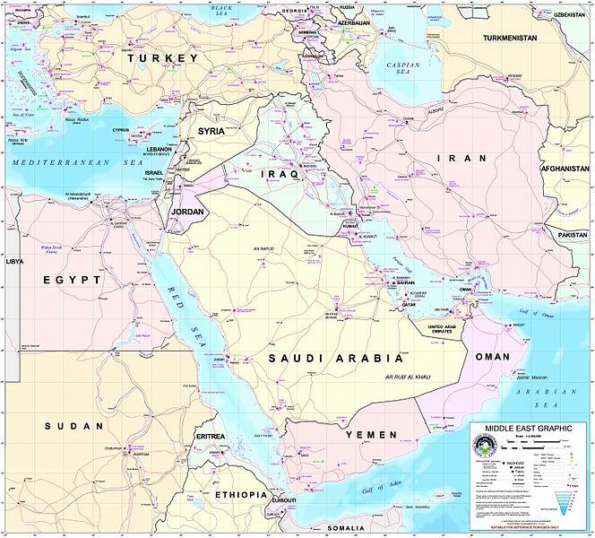
Tập tin:Middle east graphic 2003.jpg

Kích thước hình xem trước: 664×600 điểm ảnh. Độ phân giải khác: 266×240 điểm ảnh | 532×480 điểm ảnh | 850×768 điểm ảnh | 1.134×1.024 điểm ảnh | 2.268×2.048 điểm ảnh | 2.973×2.685 điểm ảnh.
Tập tin gốc (2.973×2.685 điểm ảnh, kích thước tập tin: 3,91 MB, kiểu MIME: image/jpeg)
Lịch sử tập tin
Nhấn vào ngày/giờ để xem nội dung tập tin tại thời điểm đó.
| Ngày/giờ | Hình xem trước | Kích cỡ | Thành viên | Miêu tả | |
|---|---|---|---|---|---|
| hiện tại | 22:30, ngày 8 tháng 2 năm 2012 |  | 2.973×2.685 (3,91 MB) | M0tty | Remove compression artefacts by a bilateral filtering. |
| 21:43, ngày 14 tháng 7 năm 2006 |  | 2.973×2.685 (1.013 kB) | Unquietwiki | ''Courtesy of the University of Texas Libraries, The University of Texas at Austin'' [http://www.lib.utexas.edu/maps/middle_east.html http://www.lib.utexas.edu/maps/middle_east.html] High-resolution political / railway / roadmap of the Middle East. |
Trang sử dụng tập tin
Có 1 trang tại Wikipedia tiếng Việt có liên kết đến tập tin (không hiển thị trang ở các dự án khác):
Sử dụng tập tin toàn cục
Những wiki sau đang sử dụng tập tin này:
- Trang sử dụng tại ar.wikipedia.org
- ويكيبيديا:قوالب/بذور
- ويكيبيديا:قوالب/بذور/جدول بذرة 1
- قالب:بذرة جغرافيا الشرق الأوسط
- بادية الشام
- محافظة العاصمة (البحرين)
- خليج عدن
- دزفول
- زاغروس
- مسجد سليمان
- زاينده
- مسرح أحداث الشرق الأوسط خلال الحرب العالمية الثانية
- الحويزة (مدينة)
- قائمة جزر الخليج العربي
- شرق المتوسط
- قائمة نزاعات الشرق الأوسط الحديثة
- مستخدم:Adnanzoom/مساعدات
- عبد الله بن سعيد
- قرار مجلس الأمن التابع للأمم المتحدة رقم 1381
- مستخدم:ASammour/بذرة-بوابة
- شرف الدين بن الحسن
- فخر الدين بن عدي
- صخر بن صخر بن مسافر
- قالب:بذرة أعلام الشرق الأوسط
- أبجر التاسع
- Trang sử dụng tại arz.wikipedia.org
- Trang sử dụng tại ba.wikipedia.org
- Trang sử dụng tại bn.wikipedia.org
- Trang sử dụng tại ca.wikipedia.org
- Trang sử dụng tại ce.wikipedia.org
- Trang sử dụng tại ckb.wikipedia.org
- Trang sử dụng tại el.wikipedia.org
- Trang sử dụng tại en.wikipedia.org
Xem thêm các trang toàn cục sử dụng tập tin này.


