Tập tin:Merseyside UK location map.svg

Kích thước bản xem trước PNG này của tập tin SVG: 565×599 điểm ảnh. Độ phân giải khác: 226×240 điểm ảnh | 453×480 điểm ảnh | 724×768 điểm ảnh | 966×1.024 điểm ảnh | 1.932×2.048 điểm ảnh | 1.231×1.305 điểm ảnh.
Tập tin gốc (tập tin SVG, 1.231×1.305 điểm ảnh trên danh nghĩa, kích thước: 1,3 MB)
Tập tin này từ Wikimedia Commons. Trang miêu tả nó ở đấy được sao chép dưới đây. Commons là kho lưu trữ tập tin phương tiện có giấy phép tự do. Bạn có thể tham gia. |
| Miêu tả |
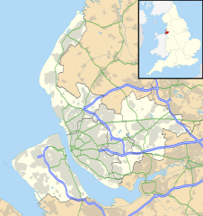
Map of Merseyside, UK with the following information shown:
Equirectangular map projection on WGS 84 datum, with N/S stretched 165% Geographic limits:
|
| Ngày | |
| Nguồn gốc |
|
| Tác giả | Nilfanion, created using Ordnance Survey data |
| Giấy phép (Dùng lại tập tin) |
Tập tin này được phát hành theo Giấy phép Creative Commons Ghi công - Chia sẻ tương tự 3.0 Chưa chuyển đồi Ghi công: Contains Ordnance Survey data © Crown copyright and database right
|
| Phiên bản khác | File:Bedfordshire UK district map (blank).svg - Blank map |
.svg)
Lịch sử tập tin
Nhấn vào ngày/giờ để xem nội dung tập tin tại thời điểm đó.
| Ngày/giờ | Hình xem trước | Kích cỡ | Thành viên | Miêu tả | |
|---|---|---|---|---|---|
| hiện tại | 19:01, ngày 26 tháng 9 năm 2010 | | 1.231×1.305 (1,3 MB) | Nilfanion | {{Information |Description=Map of Merseyside, UK with the following information shown: *Administrative borders *Coastline, lakes and rivers *Roads and railways *Urban areas Equirectangular map projection on WGS 84 datum, with N/S stretche |
Trang sử dụng tập tin
Có 3 trang tại Wikipedia tiếng Việt có liên kết đến tập tin (không hiển thị trang ở các dự án khác):
Sử dụng tập tin toàn cục
Những wiki sau đang sử dụng tập tin này:
- Trang sử dụng tại ar.wikipedia.org
- Trang sử dụng tại ast.wikipedia.org
- Trang sử dụng tại bg.wikipedia.org
- Trang sử dụng tại br.wikipedia.org
- Trang sử dụng tại ceb.wikipedia.org
- Trang sử dụng tại en.wikipedia.org
- Liverpool John Lennon Airport
- Leasowe
- Birkenhead
- Prescot
- Kirkby
- Halewood
- Huyton
- Southport
- Rainhill
- Earlestown
- Bootle
- Great Crosby
- Newton-le-Willows
- Edge Hill, Liverpool
- Litherland
- Formby
- Maghull
- Aigburth
- Allerton, Liverpool
- St Michael's Hamlet
- Crosby, Merseyside
- Little Crosby
- Waterloo, Merseyside
- RAF Woodvale
- Liverpool Castle
- Bebington
- Toxteth
- Birkdale
- Hoylake
- West Derby
- Norris Green
- Everton, Liverpool
- Croxteth
- Anfield (suburb)
- Aintree
- Port Sunlight
- Dingle, Liverpool
- Lydiate
- Switch Island
- Melling, Merseyside
- Sefton, Merseyside
- Rainford
- Speke
- Childwall
Xem thêm các trang toàn cục sử dụng tập tin này.